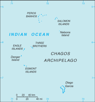
English   Română   Español   Français   Deutsch  

getamap.net

Africa

Oceania

Asia

North America

Europe

South America

Antarctica


Île Fouquet


5°19'60" S
72°16'0" E
14:10 (IOT - UTC/GMT+6)

Ile Fouquet (Île Fouquet) is a island (class T - Hypsographic) in (British Indian Ocean Territory (general)), British Indian Ocean Territory [ United Kingdom ] (Asia) with the region font code of Americas/Western Europe.

Its coordinates are 5°19'60" S and 72°16'0" E in DMS (Degrees Minutes Seconds) or -5.33333 and 72.2667 (in decimal degrees). Its UTM position is AQ90 and its Joint Operation Graphics reference is SB43-05.

Current local time is 14:10; the sun rises at 08:54 and sets at 21:01 local time (Indian/Chagos UTC/GMT+6). The standard time zone for Ile Fouquet is UTC/GMT+6
In 2024 DST starts on - and ends on -.

A Island is a tract of land, smaller than a continent, surrounded by water at high water.


Country
 Advertisements:


 Advertisements:


Weather Île Fouquet (Cloud cover, Temperature, Wind speed and Precipitation mm probab.)

Sat


Apr 27
Clound 0-10-30-100 Lightning
 
28 °C min
29 °C max
29 km/h
Thu Jan 1

Sun


Apr 28
Clound 30-10-40-100 Lightning
~9 l/m2 55%
 
27 °C min
29 °C max
22 km/h
Thu Jan 1

Mon


Apr 29
Clound 20-50-30-90 Mist Lightning
~4 l/m2 48%
 
27 °C min
28 °C max
26 km/h
Thu Jan 1

Tue


Apr 30
Clound 40-10-20-100 Lightning
~23 l/m2 72%
 
27 °C min
29 °C max
28 km/h
Thu Jan 1

Wed


May 1
Clound 40-10-50-90 Lightning
~28 l/m2 90%
 
27 °C min
29 °C max
27 km/h
Thu Jan 1

Thu


May 2
Clound 40-10-60-90 Lightning
~18 l/m2 63%
 
27 °C min
29 °C max
25 km/h
Thu Jan 1

Weather Graph

Map and Photos Ile Fouquet


Comments

--- There are no comments yet ---


Add a new comment:


You have to log in to add a comment!


Members area


Register

Forgot password?

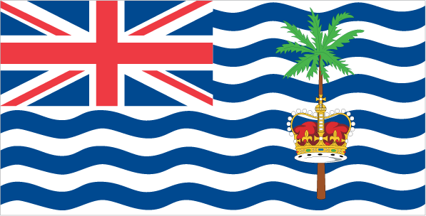
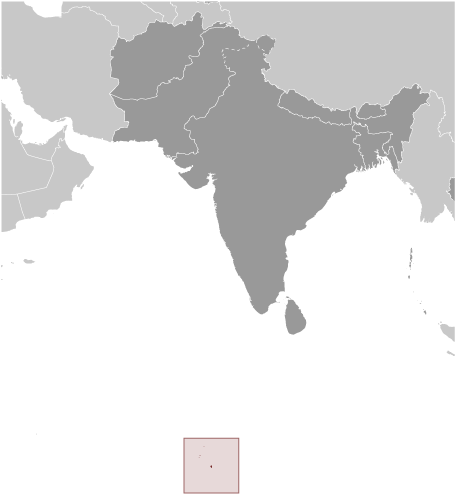
British Indian Ocean Territory [ United Kingdom ] (Overseas Territory):

Advertisement


GPS points near Île Fouquet


square Ile Sepulture (1 km)

square Ile Jacobin (2 km)

square Ile Anglaise (3 km)

square Ile Mapou (3 km)

square Ile du Sel (4 km)


square Ile Poule (5 km)

square Ile Boddam (7 km)

square Ile Diable (7 km)


GPS points from British Indian Ocean Territory [ United Kingdom ] (Overseas Territory)

square Ile Sepulture British Indian Ocean Territory (general)

square Ile Verte British Indian Ocean Territory (general)

square West Islet British Indian Ocean Territory (general)

square Grande Soeur British Indian Ocean Territory (general)

square Ile Monpatre British Indian Ocean Territory (general)

square Cust Point British Indian Ocean Territory (general)

square Coin Du Mire British Indian Ocean Territory (general)

square Ile De La Passe British Indian Ocean Territory (general)


viewweather.com sv.ViewWeather.com
fr.ViewWeather.com
da.ViewWeather.com
de.ViewWeather.com
es.ViewWeather.com
www.carpati.org
www.searchromania.net
Deblocari usi
es.getamap.org
fr.getamap.org
de.getamap.org
nl.getamap.org
da.getamap.org
www.getamap.org
Links
Terms of use
Privacy policy

# 0.0614 sec 

contact AT getamap.net

© 2006 - 2024  https://www.getamap.net/